Solving the Complexities of Commercial Satellite Imagery Collection
Planning and tasking new satellite image collection requests isn’t easy.
Even if you own and operate your satellite, you’re still grappling with a variety of factors: tasking across myriad satellite orbits, lighting conditions, weather patterns, collection angles, command and control, data backhaul networks, storage capacities, uplink and downlink ground station schedules, product production, and dissemination.
Certainly not a walk in the park. And what if you’re in the majority of folks who don’t own their satellites?
Then you’re adding another layer of complexity: reaching out to a commercial satellite company to acquire your satellite imagery. There’s a good chance your “priority” is now co-mingled with hundreds — even thousands — of customer requests, all competing for the provider’s attention in the collection queue.
It’s time for a new approach. The commercial satellite remote sensing ecosystem is ready to be integrated with software and artificial intelligence in new, meaningful ways. Every organization brings its own unique use cases, and finding a better solution will help broaden the scope and timeliness through which these use cases can be fulfilled.
Selecting a commercial satellite company for collection requests is difficult.
The current tasking model breeds a series of complications for both the customer and the data provider:
Communicating with vendors
Making an informed decision means reaching out to each satellite company — or working with a reseller to facilitate the process on your behalf. Unfortunately, it’s not as easy as looking up “satellite companies” in the Yellow Pages.
Some commercial companies employ APIs, others utilize web apps, and some require you to reach out via email. Collecting and tracking these responses can be arduous.
Comparing quotes
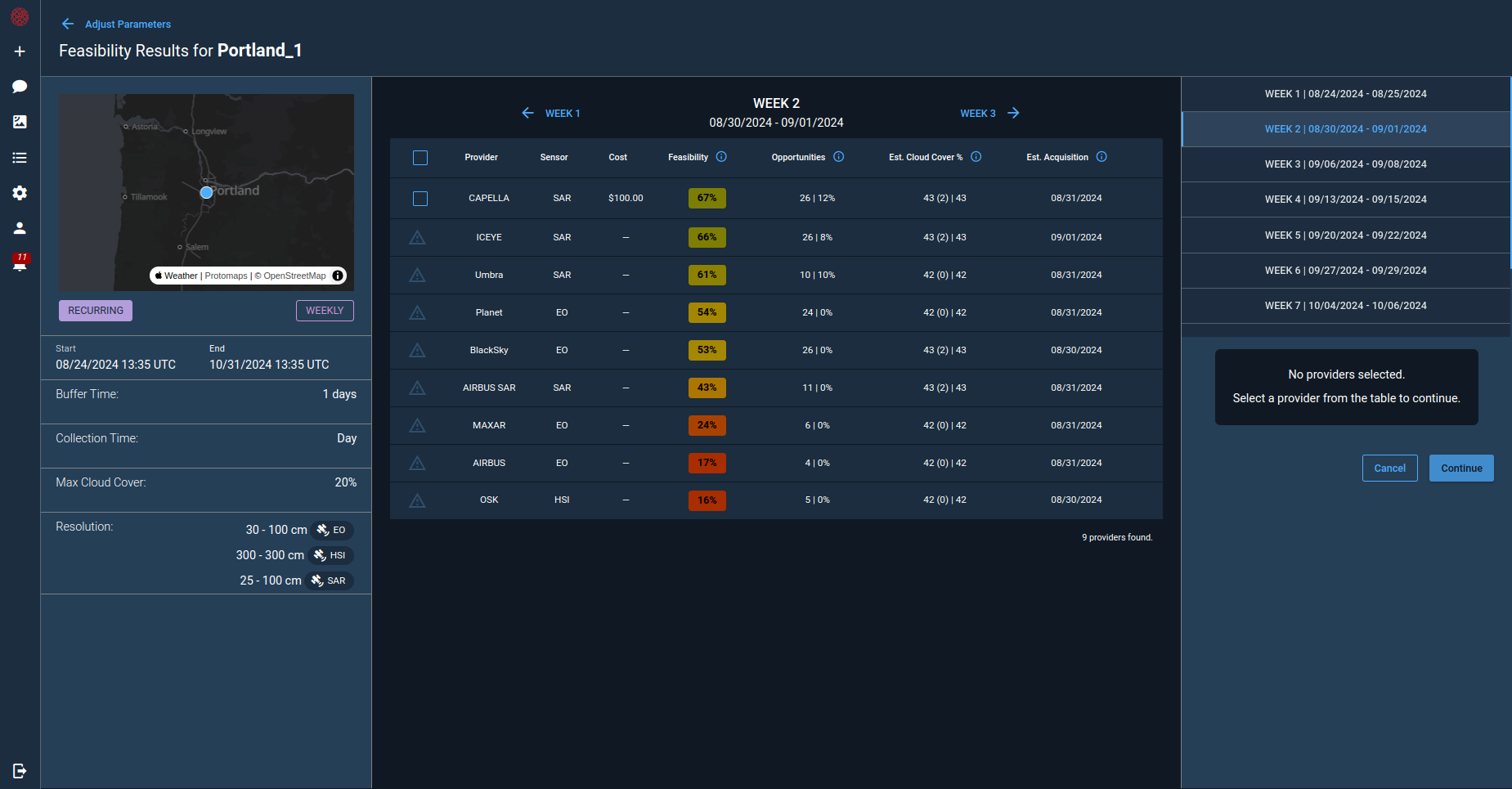
A thorough comparison is needed once you’ve collected responses from your potential partners. Several factors must be considered: timeline, quality specifications, pricing thresholds, etc. Selecting the right option often comes down to relying on professional judgment.
The waiting game
Waiting for your order to be collected is an uncertain process. A satellite orbit passing within sight of your order doesn’t guarantee that your images are collected. Perhaps another customer’s order takes precedence, or spotty weather conditions take over. Worst of all, your image collection might be delayed without you even knowing. Any ability to implement contingency planning for your requirement is out the window.
A lack of transparency
A pervasive lack of transparency from data providers only adds to a customer’s perspective of uncertainty. There’s very little information available to customers regarding the ongoing plan or feasibility of a collection attempt.
The need for multiple vendors
The market for satellite imagery is constantly evolving. More complex use cases — persistent monitoring, tip-and-cue scenarios, moving object custody tracking, and change detection-driven imaging — continue to emerge.
This means both customers often must turn to multiple data providers: one for each stage of collection. Customers have to juggle multiple different vendors, and each provider is operating in a silo — without deep knowledge of the customer’s larger end goals.
How to address the multiple-provider conundrum
We’ve established the inherent complexity of commercial remote sensing. How can we promote more reliability, confidence, and optionality? How can we enhance the delivery of satellite imagery to help the entire ecosystem?
Both government (USG) and commercial entities have launched initiatives to address the challenge of distributing tasking and new collection requests. This momentum signifies the value of solving these complex and prevalent issues.
Perhaps we can look to other industries for inspiration. For example: innovative software capabilities revolutionized the ride-sharing marketplace. In just a few years, we went from hailing a cab on the street to accessing a diverse market of vehicles from our phones — a market that fluctuates with rider requirements.
Could we adopt a similar model to the satellite world? The right software could help companies access a broad array of satellites based on demand for remote sensing data user orders.
It’s an area that’s ripe for AI and ML disruption. AI and ML can help analyze and optimize for all the variables within a satellite order: order location, timelines, price, competition, orbits, geometry, sensor type, weather, product type, etc. The right systems could help satellite data providers plan orders with maximum confidence, manage highly complex and dynamic order scenarios, and continuously improve with high-quality analytics.
With that comes improved confidence and predictability for the ordering of new satellite collections.
When there’s less friction in this area, government agencies and commercial entities can focus on the major goals of their projects— promoting security, sustainability, and economic prosperity on Earth and beyond.
Deke Young is VP, Product Management, at Cognitive Space, the market leader in intelligent space automation. With 20+ years in satellite and aerial product management, Deke excels at solving customer and market problems that create value for people, processes, and technology across commercial and government use cases.


