MEET CNTIENT.Earth™
Satellite Tasking, Simplified
Intelligently plan and order new remote sensing tasking across multiple commercial satellite data providers to confidently meet mission objectives.
Request Access/DemoAI-Powered Satellite Tasking Planning
With CNTIENT.Earth, unlock AI-powered intelligence to understand the capabilities of satellite data providers and place orders to maximize your chance of successful data acquisition. Remove the cognitive burden of requesting and evaluating the complex and diverse interactions with data providers for feasibility assessment and order responsiveness.
Scales to manage highly complex and dynamic order scenarios with demanding mission requirements like ongoing site monitoring and tip & cue. Analytics ready to support feature extraction, object detection, and chain of custody systems.
A MODERN SOLUTION FOR MODERN NEEDS
Current processes for planning and ordering new satellite data tasking are outdated and not viable for the future: they are too slow, unreliable, manual, and do not scale to meet the needs of both the data users and the satellite data providers. CNTIENT.Earth is an intelligent, automated order feasibility and order management tool that automates the interface between data users and satellite data providers - with benefits to both in terms of confidence, reliability and predictability of order fulfillment.
- AI-based automated, intelligent, and unbiased feasibility assessment of potential orders and active orders for increased visibility and confidence in order fulfillment
- Rich and intuitive web user interface for evaluating image request feasibilities and ongoing order management
- Well defined GraphQL API with webhooks for streamlined closed-loop integration
- Direct and simplified API integration with multiple satellite data providers for order entry and order status
- Supports existing and future constellations in optical, SAR, hyperspectral, RF, thermal and LIDAR.
THE CNTIENT.Earth DIFFERENCE

Access a Constellation of Constellations
Understand the new tasking supply and capabilities of all commercial satellite data providers from one interface.
Experience Real-Time Machine Intelligence
Trained on a decade of performance data and continuous learning on every new feasibility and order.
Plan with Confidence and Responsiveness
Plan, submit and adjust orders based on real-time, continuous feasibility.
Embrace Seamless Integration
Integrate with existing systems and infrastructure via modern and secure API design.
Deliver your mission with confidence
Balance operational needs, budgets and mission success at the speed of relevance.
HOW DOES CNTIENT.Earth AUTOMATE OPERATIONS?

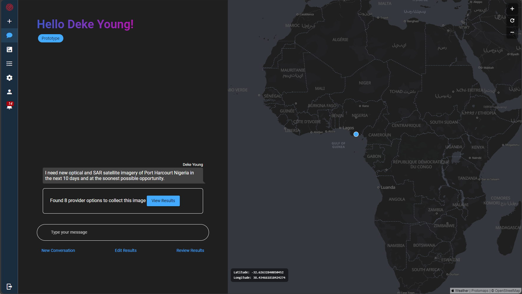
The AI Assistant uses an LLM (Large Language Model) to enable unstructured natural language requests from users to be intelligently evaluated for satellite imagery collection.

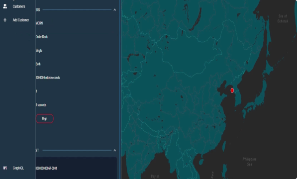
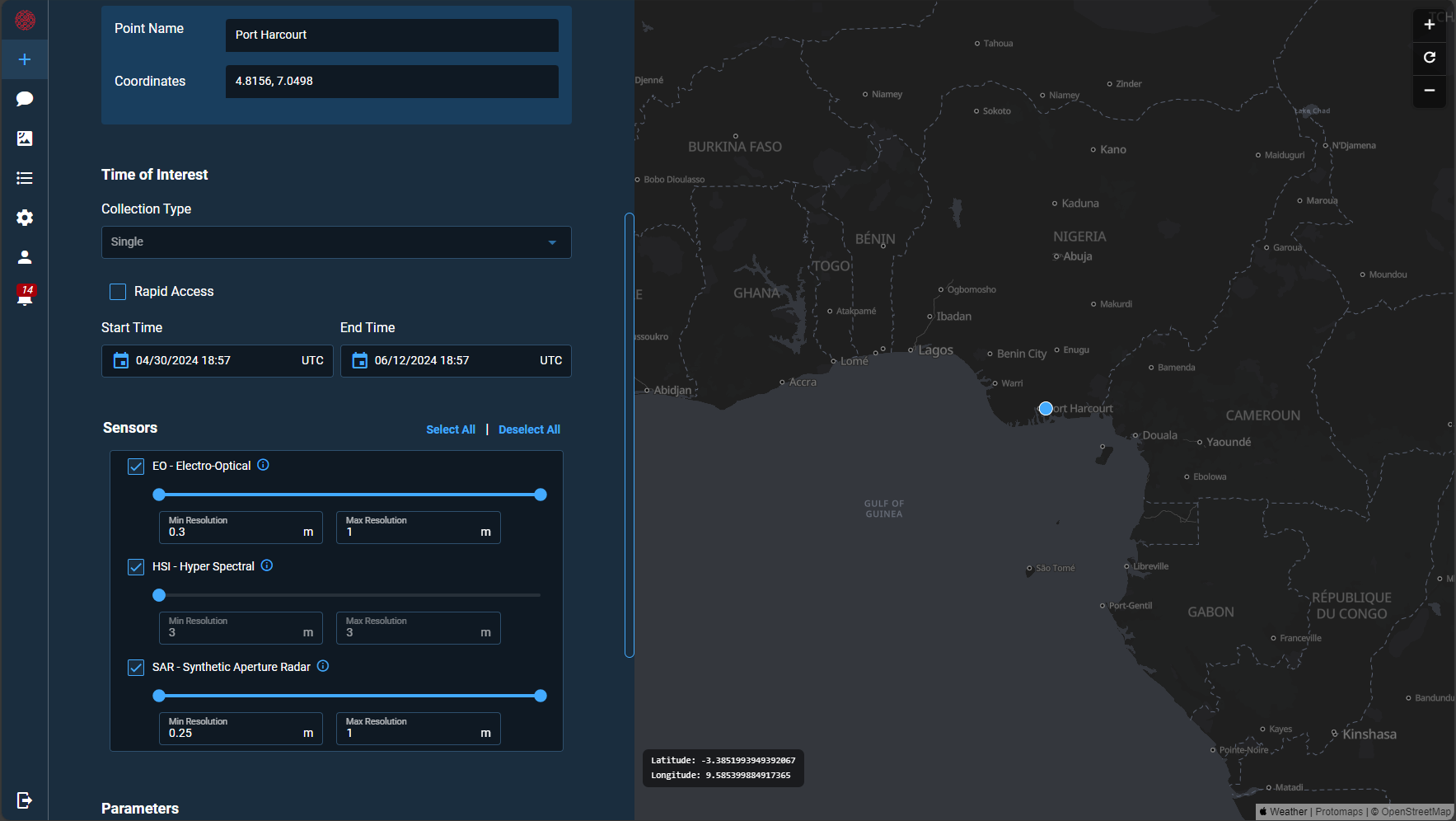
The user can also define the imagery request parameters in a simple and intuitive user interface or in machine to machine interactions through a GraphQL API.


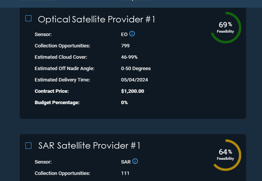
CNTIENT.Earth selects data providers capable of fulfilling the imagery request and our proprietary AI cognition engine provides an unbiased, intelligent estimate of the collection feasibility and estimated price based on existing contracts or list pricing. The user can select one or more data providers to submit orders directly to data providers’ APIs.

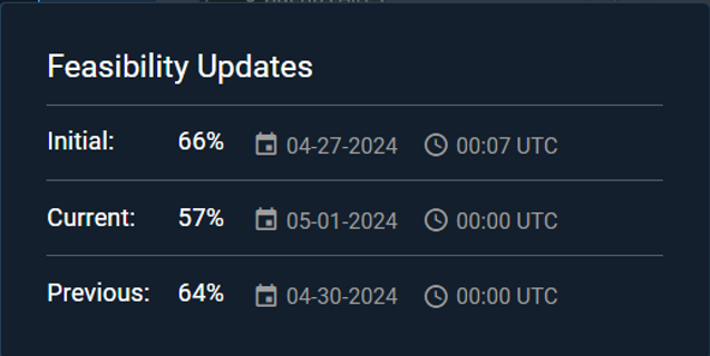
Ongoing feasibility updates are provided by the AI cognition engine for all open and active orders to provide the user with continuous updates on their collection feasibility.

ORDERING NEW TASKING OF SATELLITE IMAGERY DOESN’T HAVE TO BE HARD
The process of tasking commercial remote sensing satellites in today’s diverse market of providers is is a complex problem. Complexity exists in multiple steps of the process including; matching requirements to available sensor capabilities, understanding feasibility of collection in the required timeline, understanding impacts of weather and other collection planning variables, and coordinating multiple commercial providers with different methods of communication. Cognitive Space’s enterprise SaaS solution, CNTIENT.Earth, was specifically developed to address the complexity and uncertainty of ordering new remote sensing tasking across multiple commercial satellite data providers. CNTIENT.Earth enables new image tasking requests to be quickly, effectively and intelligently considered for fulfillment across all available commercial satellites - to reduce friction and achieve mission success quickly and confidently.
- Intelligently evaluating, managing, and ordering commercial collection requests on a global scale.
- AI/ML core capability reduces uncertainty and improves tasking selection across multiple potential satellite data providers.
- Can integrate with any 3rd party API, mapping, monitoring or analytics systems through flexible GraphQL interface.
- Software-as-a-Service - no need to install servers, no maintenance costs

